Sunday, 17 April 2016

ISPA Instructor Clinic in Comox, BC

I will be in Comox for the week taking part in a Method of Instruction and Practical Sailing Evaluation Clinic in order to become an ISPA certified Instructor for the ISPA Competent Crew and Day Skipper sail programs.

ISPA (International Sail and Power Association) is a western Canada based Sail and Power instruction program -  http://www.ispassociation.ca/
 
View from the DSYC dock...
Monday and Tuesday was spent preparing Lesson Plans on various sailing topics and then presenting to the group. Feedback was provided by all.

S/V Gloman Magic - our Instruction vessel for the Clinic

Wednesday was spent on the boat and on the water, again in instruction mode - topics such as engine start-up procedure, standing and running rigging, and knots. On the water topics included the sailing circle. We did quite a few heave-to COB's - some of us with questionable success.


Comox Valley Marina

Thursday was spent maneuvering the boat under power and doing several single line dockings. This a great technique for a short or single handed crew, then it was out to do more heave-to COB with much better success.

View towards Vancouver Island and the Comox Glacier

At the conclusion of the day it was announced that we had all passed the Clinic - it was a sigh of relief after the last 2 strenuous days.

ISPA Instructor Class of 2016
Two Bilge Keeled Boats at CVM - Purposely Aground

Saturday, 20 February 2016

Sextant Accessories...

Here is what my kids think that I look like when I am using my sextant...


Tuesday, 9 February 2016

Guerrilla Celestial Navigation

Probably not too different from what blue water navigators have had to do to catch a sight and determine a fix - I coin the term Guerrilla Celestial Navigation not so much as replicating or performing to an art form but to do what you might have to do to the best of your abilities or circumstances - to get the job done.

I have used the same term when making sushi at home - the art form is not practiced just the raw production of most times very tasty sushi.

So what constitutes Guerrilla Celestial Navigation? Here goes...

- taking a sun sight against a near shore horizon because that is all you have
- waiting for an opening in the cloud cover to get a sun sight while you can before losing it to the next cloud
- catching a sun sight when you have light cloud cover
- trying to guess where the limb of the sun is during an obscured sight

Take what you can when you have it - while you have it.

Tuesday, 2 February 2016

Worksheet and Tables vs. StarPilot TI 89 Calculator

For the past few days I have been working with the StarPilot TI 89 Calculator and comparing process and results. The plan to work with the calculator was to keep working to find a quick and accurate way to process sights so that while on a boat under varying conditions I could develop an accurate fix in as brief a processing period possible - for the purpose of continuing to develop the toolkit towards an 'acoustic' and practical approach to Celestial Navigation.

I don't want to see myself spending 15 to 30 minutes determining a fix, while thumbing through multiple tables, making mistakes and getting sea sick while below.

All sights were taken with a Davis Mark 25 plastic sextant through an artificial horizon - under near perfect viewing conditions. All sights were taken at local time and adjusted for watch error. Each sight session consisted of 3 sights and averaged.

All worksheet sights were reduced via Pub 249 Vol 3 Tables.

From the following:

Course and Speed:        000d 0Kn (Stone Frigate)
Actual Position:            N43d43.0'   W079d24.0'
DR:                               N43d           W079d
Date:                             1 Feb 2016

Sight #1                        Sun UL
                                      UTC = 15:50:09
                                      Hs = 25d16.8'
                                      Lon AP = 079d09.7'

Sight #2                        Sun LL
                                      UTC = 18:23:11
                                      Hs = 27d50.1'
                                      Lon AP = 079d24.9'

Sight #3                        Sun LL
                                      UTC = 20:10:15
                                      Hs = 19d00.1'

The results:                   Worksheet              StarPilot

Sight #1                         Zn = 153d T           Zn = 153.5d T
                                       Int = 39' A              Int = 42.3 A


Sight #2                         Zn = 194d T          Zn = 194.6d T
                                        Int = 38' A             Int = 34.2 A


Sight #3                          Zn = 221d T          Zn = 220.9d T
                                       Int = 21' A              Int = 16.6' A


Fix                                  N 43d 38.0'            N 43d 38.9'
                                       W 079d 27.0'          W 079d 24.9'


Accuracy                        within 7 nm            within 5 nm


With StarPilot...
- DR is the AP
- a bit more accurate
- takes about 2 minutes versus 15 to 20 minutes to determine a fix
- keep spare batteries and sea water out - no solar power

Clearly the Starpilot approach is very accurate and very quick to produce a fix and I can't wait to do the real thing on the water.

Here are the Worksheets and the Plot...

Sun Sight #1

Sun Sight #2

Sun Sight #3

Plotting Sheet Comparing Worksheet and StarPilot (in Red)

Monday, 18 January 2016

Tables versus Calculator - Who Wins?

In my quest to develop a practical and pragmatic approach to celestial navigation, I have been exploring the use of a calculator to perform sight reductions. This doesn't eliminate the need for worksheets yet but does open further opportunities to get into the mathematical background of celestial navigation. I don't intend to become a mathematician but to understand as much as I can the workings and solutions of the navigational triangle. So far two formulas form the basis of sight reductions by calculator. They are...

sin Hc = (sin d x sin L) + (cos L x cos d x cos LHA)

and

cos A = (sin d - (sin L x sin Hc)) / (cos L x cos Hc)

where...
Hc = Computed Altitude
d = declination
L = Latitude
LHA = Local Hour Angle

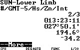
A programmable scientific calculator is needed to store programs and retrieve the variables. Not too expensive - if you end up going this way on a long ocean passage, a backup or two would be wanted.

These two formulas are just the tip of the spherical trigonometry ice berg. I will explore others that are at least as approachable - remember I'm not a mathematician, or an astrophysicist - yet.

The results have been interested and add another dimension to all of this. In my wish to be able to take real sights and perform real navigation on the water during a passage, the following benefits are observations come to bear:

- Need only the Nautical Almanac
- No need to carry Pub 249 (Vol 2 and 3) Tables
- Vol 1 is needed for preplanning of star sights
- No need to carry Pub 229 Tables
- No need to apply Precession and Nutation corrections
- Assumed position can be the exact DR for Lat and Long - which allows for an increased level of accuracy because whole numbers for Lat and LHA are no longer required
- Azimuth correction is achieved
- Must use a stars SHA to determine the stars LHA for Hc
- Accuracy of fixes can be better by calculator - but by tables could sometimes be more accurate than  calculator - I will need to do a bunch to see how this holds up and possibly to determine why

Sight reduction by calculator doesn't dismiss the paperwork done by worksheet but it does allow you to be a bit quicker in performing the work to arrive at a fix - without having to leaf through multiple pages of tables and entries. There are lots of opportunities to make a mistake and the calculator takes away a few of these opportunities.

The worksheets are still key to arriving at Ho, LHA and dec - which are the entry points to the Pub 249 and 229 tables.

I accept the use of a calculator as part of the 'acoustic' environment because the calculator doesn't rely totally on battery power but is also solar powered. Exposure to salt water spray or being dropped overboard will negate any attempt to be entirely self reliant in the goal of navigating through human and natural power.

Monday, 28 December 2015

Dip Short in Celestial Navigation

For those that practice Celestial Navigation in Coastal, Inland or locations where a proper sea horizon can't be obtained - a correction can be made to compensate for that shortfall - it is call Dip Short, for when the distance to a natural sea horizon is shorter. Of course this won't be of much use other than to practice obtaining your sights because in those locations you really ought to know where you are anyway through other means.

My source for this is John Karl's Celestial Navigation in the GPS Age.

The simple formula is...

DipShort = 0.415767 x d + 0.565786 x h / d, where d is distance in nm and h is height in feet

Or the following Table...


Thursday, 17 December 2015

Celestial Navigation Videos by Navigation Training...

I came across the YouTube channel just recently. A terrific primer on CelNav filmed on location off a sailboat and beaches of the West Indies - I will go there for this course anytime!

The YouTube channel for all videos can be found here...

https://www.youtube.com/playlist?list=PLah9ocjQNN0Zr7-oKE58wTzXE4XaQU64E

The intro here...


A number of resources - books, sites, etc. can also be found on this related web site...

http://www.practicalnavigator.org/

Well done Chris Nolan.

Have fun!